• colorado
    • colorado
    • rocky mountain nat'l park
    • comanche nat'l grassland
    • pawnee nat'l grassland
    • a perfect hike
    • san luis valley
    • dinosaur
  • travels
    • southern africa
    • australia
    • costa rica
    • france
    • italy
    • montréal
    • hawaii
    • utah
    • texas
    • california
    • oregon
    • nyc
    • vermont
    • cape cod
    • washington
    • california zephyr
    • prairie road trip 2017
    • nebraska
    • usa road trip feb 2016
    • usa road trip 2016
    • u.s. landscapes
    • woodstock ny
    • edaville usa
  • series
    • birds
    • transformations
    • my grandparents' old house
    • window seat
    • mandalas
    • vanishing point
  • portraits
    • people
    • headshots
    • families
    • 2fik/colorado
    • 2fik/nyc
  • weddings
    • wedding intro/contact
    • couples
    • moments
    • details
  • gallery shows
    • urbane - bitfactory gallery
    • open spaces
    • no show
    • us
    • things of beauty
  • blog
  • about/contact

Jeremy Patlen Photography

  • colorado
    • colorado
    • rocky mountain nat'l park
    • comanche nat'l grassland
    • pawnee nat'l grassland
    • a perfect hike
    • san luis valley
    • dinosaur
  • travels
    • southern africa
    • australia
    • costa rica
    • france
    • italy
    • montréal
    • hawaii
    • utah
    • texas
    • california
    • oregon
    • nyc
    • vermont
    • cape cod
    • washington
    • california zephyr
    • prairie road trip 2017
    • nebraska
    • usa road trip feb 2016
    • usa road trip 2016
    • u.s. landscapes
    • woodstock ny
    • edaville usa
  • series
    • birds
    • transformations
    • my grandparents' old house
    • window seat
    • mandalas
    • vanishing point
  • portraits
    • people
    • headshots
    • families
    • 2fik/colorado
    • 2fik/nyc
  • weddings
    • wedding intro/contact
    • couples
    • moments
    • details
  • gallery shows
    • urbane - bitfactory gallery
    • open spaces
    • no show
    • us
    • things of beauty
  • blog
  • about/contact

Denver Alleys

Since I started taking photos, I've been drawn to long straight paths - vanishing points. There's a certain magnetism that makes my eyes and sometimes my feet wander, guided by light. 

Denver has systems of long, stretching alleyways in many neighborhoods. Most are purely functional and non-descript, places to park your car or to put your trash out for collection.  Certain areas, such as Lodo, have more trafficked and utilized alleys. Very few are what you'd call pretty. They're not faster to walk down than the sidewalk and some of them are trash-strewn and, well, gross.

I try to find beauty in unexpected places and in the mundane. I still contend that you don't always have to look too hard, even in urban alleys.

Too be continued, I'm sure.

Photo #7 NSFW.

View fullsize IMG_1157.jpg
View fullsize IMG_1849.jpg
View fullsize IMG_2563.jpg
View fullsize IMG_1093.jpg
View fullsize IMG_1663.jpg
View fullsize IMG_1823.jpg
View fullsize IMG_1612.jpg
View fullsize IMG_1616.jpg
View fullsize IMG_1653.jpg
View fullsize IMG_1672.jpg
View fullsize IMG_6366.jpg
View fullsize IMG_6327.jpg
View fullsize IMG_6340.jpg
View fullsize IMG_6344.jpg
View fullsize IMG_6356.jpg
View fullsize IMG_6764.jpg
tags: alley, denver, colorado, chasing light, resistancethroughbeauty
categories: travel writing, travel photography
Thursday 03.23.17
Posted by Jeremy Patlen
 

Flying in a very small plane

Boulder, CO, from the sky

Longmont, CO

Skydivers drifting into Longmont Airport

Marijke, "Flygirl", my friend a pilot for this trip

Not long after arriving in Denver, a friend invited me to go for a flight in her two-seater plane, a 1976 Citabria 7KCAB. I have always enjoyed looking out at the world from airplane windows and couldn't pass up this opportunity.

Standing next to Marijke's plane, I was immediately struck by the fact that something so human in scale can take us safely into the sky and back. Commercial passenger aircraft are huge - it's hard to sense just how big they are until you're on the ground looking at them, not getting onto one via an airport jetway. They're also solid, made of metal and plastic and don't wobble as you're climbing into it. The plane I climbed into, produced by American Champion, was originally designed to train pilots in aerobatic flying. They're made of fabric covered steel tube frames and have wood spar wings. You can feel its lightness in the air - how it rolls, bounces and glides on gusts of wind. It's absolutely exhilarating to fly, slowly, so close to the Flatirons and Rocky Mountains. Thanks, Marijke!

Evergreens from the sky

Moraine Park, RMNP

Sports fields from above

A prairie dog town

You can see more of my aerial photography here.

tags: aerial photography, colorado, boulder, front range, aviation
categories: travel, travel photography, travel writing, aerial photography
Thursday 06.02.16
Posted by Jeremy Patlen
 

San Luis Valley, Colorado

The Sangre de Cristo mountains behind flooded fields.

Great Sand Dunes National Park

Partially frozen Zapata Falls, detail. 

Crows circling an abandoned house near Crestone, CO

This is what happens when you take an iPhone pano in a car moving at 80 mph.

(go directly to photo gallery)

The first time I saw the San Luis Valley, I was mesmerized. It was on the first day of the road trip through the south-west that I took in February 2016. A friend recommended that we take CO 285 south into New Mexico, opting for smaller country roads rather than the interstate. I made a mental note to go back to this part of the state. Little did I know that life would bring me back just a few weeks later.

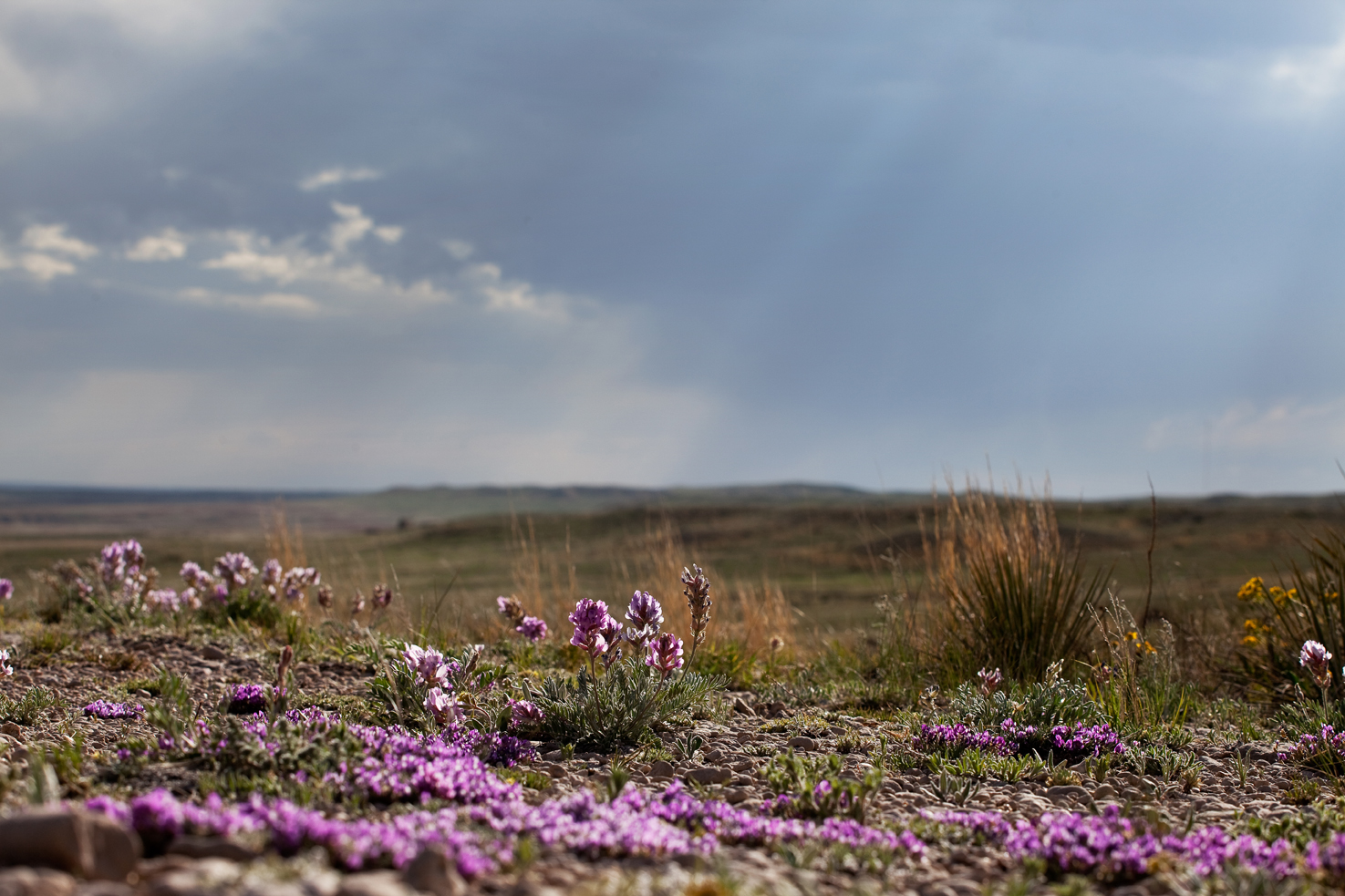
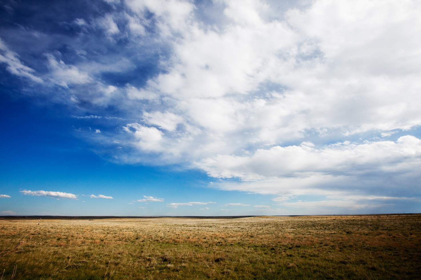
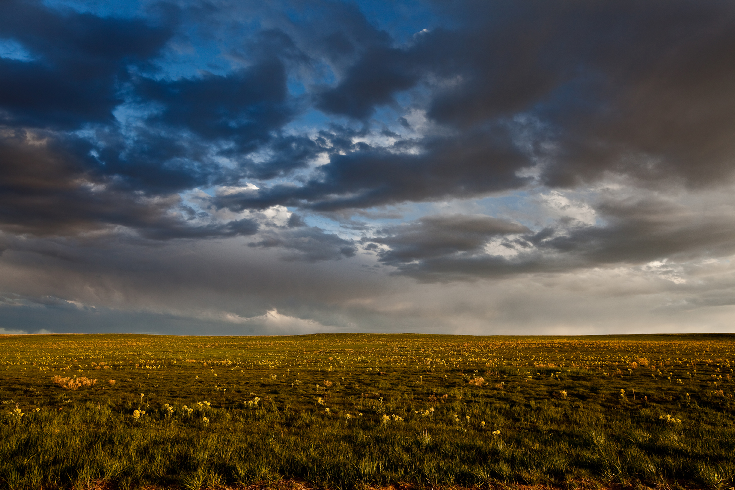
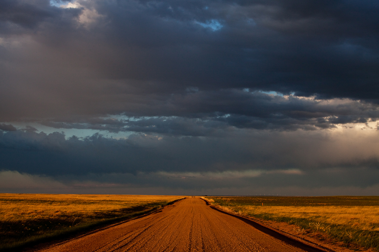
The scale and vastness of this valley is deceptive. Perception is altered; something 30 miles away seems like it should only be a 10 minute drive. Rt 17 or 285 cross the valley with barely a kink in the road for 50 miles. It's surrounded by Sangre de Cristo range to the east and the San Juan mountains to the west. In between, nothing but dusty, flat farmland, off-the-grid houses, a UFO lookout tower and campground and even an alligator farm, if it's not yet sold.

Nestled into the Sangre de Cristo mountains lay the largest sand dunes in North America. Designated as national parkland by President Clinton in the 1990's, Great Sand Dunes National Park is visible clear across the valley floor. An open expanse of protected sand, you're free to wander and camp anywhere you can walk. Be prepared for blazing hot sun and one serious leg and cardio workout.

About 10 miles from the park entrance, up a dirt road and another half-mile hike are Zapata Falls. I imagine they would be wonderful for a splash in the heat of the summer. In early March the falls were still frozen over, spectacular in their stillness.

Every spring, sand hill cranes migrating northward stop in the Monte Vista National Wildlife Refuge. In the morning they take off en masse to do what cranes do before returning to roost for the night. I arrived later than I had wanted to in the morning, but there were still thousands of them around.

Americana at the gas station in Hooper, CO

Practicalities: It will take you about 3-4 hours each way from Denver, long enough to want to spend the night there rather than just take a day trip. Make sure you book accommodations before you go as there are very few places I noticed on the roads. There are gas stations, stores and restaurants throughout the area but towns are small, some just junctions in the road. There was a surprisingly good barista in the art gallery next to the post office in Moffat and a much bigger downtown in Monte Vista. Make sure you carry plenty of water if you're planning on hiking on the dunes.

tags: Nature photography, great sand dunes national park, mountains, great sand dunes, monte vista, crestone, colorado, cranes, sandhill crane, Travel writing, road trip, sand dunes, Travel photography
categories: travel writing, travel, travel photography
Sunday 05.29.16
Posted by Jeremy Patlen
 

Pawnee National Grasslands, Colorado

(go directly to photo gallery)

Heading north on I-25, then east, few traces of either urban Denver or the Rocky Mountains remain.  You're suddenly on the often overlooked and flown over prairie side of Colorado. Small towns centered around farming and cattle spring up and you pass signs that read "no gas for 60 miles."  Two hours north-east of Denver, near the borders of Wyoming and Nebraska, two parcels of land called the Pawnee National Grassland are tucked into this slightly out of the way section of the state. Before moving here, I had never heard of the Pawnee; I first learned of its existence when I noticed two green squares on the map.

Wildflowers and rain clouds over the Pawnee Grasslands

Some simple research taught me that these are some of the few areas of native shortgrass prairie left in North America. I was immediately intrigued and wanted to explore - we simply don't have land like this where I come from. They were set aside by the federal government after the dust bowl in the 1930's. Over the years, they became a refuge for wildlife and internationally known in the birding world. Within the past 10 years, however, development by the energy industry has increased to the point that some parts of the western section of the national Grassland seem more managed than the surrounding farms. Traces of drilling or fracking are impossible to ignore, as are the giant windmills that are the new backdrop for the Pawnee Buttes. Gas trucks roll by, each trailed by a pillow of dirt.

Pronghorn, seen within 1/2 mile of entering the park on CO-14 near Keota.

Mailbox, tumbleweeds. Pawnee National Grassland.

Cattle, windfarms, on the road to Grover from the Pawnee Buttes.

Wind farms are impossible to miss near the Pawnee Buttes.

Despite all of the human activity, it is still stunningly beautiful. This is where the buffalo roam(ed) and the deer and the antelope (still) play. You can still see vast, undulating vistas to the horizon without roads or industry. Quick and driving rains pass through, leaving behind colder air and rainbows. Pronghorn, prairie dogs and abundant bird life still live here, especially in the few parts of the western tract that I saw on my first visit. You can still get glimpses at this extraordinary, dramatic and beautiful landscape while we still have it.

IMG_0295.jpg
IMG_0273.jpg
IMG_0469.jpg
IMG_0514.jpg
IMG_0444.jpg
IMG_0433.jpg
IMG_0482.jpg
IMG_0295.jpg IMG_0273.jpg IMG_0469.jpg IMG_0514.jpg IMG_0444.jpg IMG_0433.jpg IMG_0482.jpg

To see more of my photos of the Pawnee National Grassland, click here.

Practicalities: If you go, be prepared to bring anything you'll need for the day. Hiking boots, a walking stick (rattlesnakes are common), sunscreen, water, food, and a full tank of gas are essential before you go. The only facilities I saw were standard park issue latrines in the parking area by the buttes. No stores, no gas stations, nothing of note once you're past Greeley. Once your in the grasslands, most roads are dirt and are a mess when it rains - it takes longer to get around than you would think. Cellphone coverage was surprisingly strong and Google maps worked for most of the day, even if some recommended routes weren't possible as I don't have 4 wheel drive. Bring warm clothes even on warm days - the temperature can drop very quickly.

If you want to read more about recent changes at the Pawnee, Westword wrote a very interesting piece on it last year.

tags: colorado, landscape photography, Nature photography, seeitwhileyoustillcan, environment, Travel writing, natgeo, pawnee, grasslands, Travel, Photography, Travel photography
categories: travel, travel photography, travel writing
Wednesday 05.25.16
Posted by Jeremy Patlen